Asphalt Ghosts: The Lost American Highways Still Hiding in Plain Sight
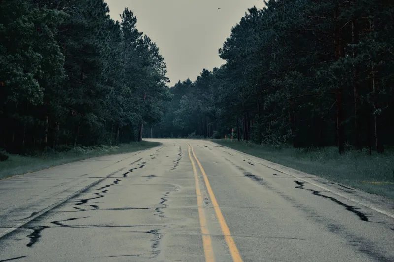
There's a particular kind of map that stops you cold — not because it shows you somewhere you want to go, but because it shows you somewhere that no longer exists. Pull up a road atlas from 1955 and trace your finger along a highway that, by all modern accounts, has simply vanished. No app will route you there. No interstate sign will acknowledge it. And yet, if you know where to look, the road is still there, cracked and patient, waiting for someone to notice.
America has hundreds of these forgotten thoroughfares. Decommissioned, bypassed, or quietly erased from official maps, they are the ghost roads of the U.S. highway system — and for a growing community of travelers, historians, and cartography obsessives, they are absolutely worth finding.
The Map That Started It All
The Federal Aid Highway Act of 1956 didn't just build the interstate system — it effectively sentenced thousands of miles of older U.S. routes to a slow, unglamorous retirement. Towns that had once thrived as pit stops on busy two-lane corridors suddenly found themselves miles from the nearest on-ramp, bypassed by engineering efficiency and the relentless American appetite for speed.
If you overlay a 1940s road atlas with a current satellite image of, say, central Illinois or rural Georgia, the differences are jarring. Old alignments of U.S. Route 66 snake through fields that have long since swallowed the shoulder lines. Former segments of U.S. 40 — once nicknamed the "Main Street of America" — dissolve into gravel driveways and county roads that locals use without a second thought.
For anyone who loves maps the way we do here, this kind of comparison is almost addictive. You start pulling at one thread and suddenly you're three hours deep into a 1938 highway department survey, cross-referencing it with Google Earth, trying to figure out why a particular tree line runs at an oddly deliberate angle through an otherwise random patch of Indiana farmland.
(Spoiler: it's a roadbed. It's almost always a roadbed.)
What the Pavement Remembers
These roads don't disappear cleanly. Asphalt is stubborn stuff, and even decades of neglect leave traces. Travelers who've gone looking for old alignments — and there are forums, Facebook groups, and entire YouTube channels dedicated to exactly this — describe finding stretches of original highway surface hiding under a thin skin of encroaching grass. Concrete expansion joints still visible. The ghost of a white centerline, sun-bleached to near-invisibility but unmistakably there.
In the Texas Panhandle, a decommissioned stretch of old Route 66 runs parallel to I-40 for miles, accessible by a simple turn off the frontage road. Drive it on a weekday afternoon and you might not see another car. The silence is the kind that feels intentional, like the road itself is asking you to slow down and pay attention.
In Pennsylvania, old alignments of the Lincoln Highway — America's first transcontinental road, established in 1913 — still pass through borough centers that the modern U.S. 30 has long since bypassed. You'll roll through town squares with elaborate brick paving, past diners with neon signs that look like they were last updated when Eisenhower was in office. Some of them were.
Economic Echoes Written in Concrete
Here's the thing about ghost roads that maps make brutally clear: infrastructure shapes destiny. When a highway moves, so does everything built around it. The motels, the diners, the gas stations, the whole economy of motion that a busy road sustains — it migrates toward the new route, and what's left behind enters a kind of suspended animation.
Some of those bypassed towns have found second lives as antique destinations or heritage tourism stops. Others have simply contracted, their populations drifting toward wherever the jobs followed the traffic. Drive enough old alignments and you start reading the landscape like a historical document — the size of the buildings, the vintage of the signage, the ratio of open storefronts to empty ones all telling a story about when the highway moved and how hard the community worked to adapt.
It's not a simple story of decline, though. Some of the most vibrant small-town communities in America sit on roads that most GPS systems would route you around. They've built identities around their off-the-beaten-path status, leaning into the slowness and the authenticity that comes from not being a highway town anymore. There's something quietly radical about that.
How to Find Them Yourself
If this has you itching to go looking, good — that's the whole point. A few starting places:
Old highway enthusiast communities like the U.S. Ends website and various Route 66 preservation groups have documented dozens of surviving alignments with enough detail to plan an actual road trip around them.
Historic USGS topographic maps, available free through the USGS National Map viewer, are invaluable for spotting old road corridors that have since been reclassified or abandoned. Compare them to current satellite imagery and the differences leap out.
State highway department archives are an underused resource. Many states have digitized historical road maps going back to the 1920s and 30s, and they're usually available through state library systems at no cost.
Just drive slowly. Seriously. Old alignments often intersect with or run alongside current roads in ways that are obvious once you know what to look for — sudden changes in pavement texture, oddly wide shoulders, a bridge that's clearly older than the road it's on.
The Map Is the Journey
What makes ghost roads so compelling, from a cartographic standpoint, is that they force you to read landscape as a layered document rather than a fixed image. A map isn't a photograph of reality — it's a snapshot of priorities at a particular moment in time. Roads appear and disappear based on politics, economics, technology, and sometimes just the whims of a state highway commission that decided a particular route needed straightening.
When you trace a forgotten alignment on an old map and then go find it in the real world, you're doing something genuinely meaningful: you're insisting that the past has spatial presence, that history isn't just in books but in the actual ground beneath your feet.
America's ghost roads aren't failures. They're archives. And some of the best travel experiences available in this country right now are sitting on stretches of asphalt that your phone has been trained to ignore.
Maybe that's exactly why they're worth seeking out.